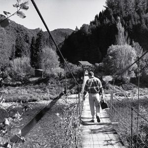
Drenching rain, lush forests, rivers that regularly inundate the land, even sandflies and that fierce human independence bred by isolation—all that is the West Coast can be traced ultimately to the towering presence of the Southern Alps. Yet from a geological perspective these mountains are mere outward symptoms of greater things happening beneath the ground, where two of the world’s tectonic plates collide along one of Earth’s greatest fault lines, dubbed the Alpine Fault. Geologists Harold Wellman was the first to recognise this vast structure, a discovery that helped revolutionise the way we see the Earth.
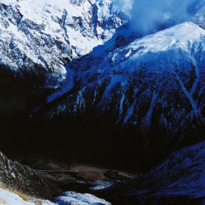
A Large Land, uplifted high, bearing south-east of us,” was how Abel Tasman recorded that first glimpse which Europeans had of New Zealand, on December 13, 1642. Approching from Tasmania, the Dutch explorer encountered the West Coast about the latitude of Punakaiki, before turning north towards his fatal encounter with the Maori of Taitapu (Golden Bay). The line of the towering Southern Alps rising steeply above the narrow coastal strip of the West Coast remains one of the most impressive views in the country.
But why are they “uplifted high”? What pushed up the land to make the great wall of the Southern Alps? Geologists puzzled over this question for a century before one of them went to the same mountains that many others had looked at, but saw what others had missed, and comprehended what they had not dared to believe. Harold Wellman not only recognised one of the most extraordinary geological structures in New Zealand, but his insight into what must have happened there helped set off a revolution in science. It helped change the way we think about the way the Earth works.
Harold Wellman is a geologist with a more varied experience than most.
He first came to New Zealand from Britain in 1927 when he was 18, and soon found steady work as a surveyor’s assistant. In 1932, he obtained his own ticket as a registered surveyor, but in the Depression, work was scarce. He did some work in Napier in the aftermath of the 1931 earthquake, and surveyed the site of a garage at Ninety Mile Beach, to be erected in conjunction with an attempt on the land speed record by one Wizard Smith. The attempt fizzled, and Wellman joined the unemployed.
He drifted south, carrying his swag down the West Coast from Grey-mouth, prospecting for gold as far as Gillespies Beach and the Haast. Along the way, he and a mate learned the trick of washing fine gold from the black sands by trapping it on a woollen blanket in the bottom of a box.
He wandered back up the Coast with money in his pocket, past Greymouth and Buller, on to Karamea and finally Collingwood via the Heaphy Track.
Harold Wellman (left), a surveyor and sometime gold prospector, studied geology part-time at university before securing employment as a professional geologist. When this photograph was taken, about 1944, he was based in the Greymouth office of the former Department of Scientific and Industrial Research, where a major coal survey was under way. Maxwell Gage, his companion on this field trip, later became professor of geology at Canterbury University.
The government of the time wanted to encourage gold prospecting—it provided wealth for the country and work for the unemployed. Thus in 1934 the government Unemployment Board made a large grant to the Department of Scientific and Industrial Research to make geophysical and geological surveys to locate likely gold-bearing deposits as a guide to prospectors.
Wellman, now an experienced and occasionally successful prospector as well as surveyor, wrote to the DSIR for a job and was sent to join the geophysical survey team. For the next few years he worked in this capacity, again mainly on the West Coast. His boss told him he would never get far in the DSIR without a degree, so he also began extramural university studies.
By the end of 1940, he had spent a year working as a geologist in New Guinea, married, completed a masters degree in geology, transferred from the general to the professional staff of DSIR (with a big pay increase), and was on his way as a geologist He was to become something of a maverick, however, never in line for the top jobs, but always full of ideas, and with the physical and mental energy and agility to leave his more pedestrian colleagues several steps behind. But his ideas were always based on extensive fieldwork and merited careful consideration.
In 1958, he moved to Victoria University where his love of debate and scorn for dogma and orthodoxy endeared him to students and offended colleagues. Wellman could be accused of many things, but never of politeness, said a colleague. He was never happier than when debating some geological problem, preferably with a beer in front of him and, in the earlier days, with tobacco in hand. Even in government department days, Wellman was credited with instituting the pub as the main forum for geological debate. At the university he was a willing participant in student parties with their raucous singing, copious quantities of home brew, and outrageous pranks. He is reported to have started a short-lived fad among the students for consuming live garden snails, shells and all. But among the antics and the aggravation, Wellman made respected contributions on a broad range of geological fronts, resulting in his being made a professor and a fellow of the Royal Society of New Zealand and being awarded a DSc degree.
But all this was well in the future when Wellman received his first assignments as a DSIR geologist. These first tasks were mainly to assist the war effort. In 1940, he and another newly graduated geologist, Dick Willett, were sent to search for mica, a strategic mineral needed to make electronic components for radio equipment. They examined a deposit in Fiordland, which proved to have been worked out, and then made several expeditions to check other deposits reported by a prospector in South Westland. They found enough mica to meet New Zealand’s wartime needs, and also took the opportunity to examine an area few geologists had visited before. In particular, they saw that the steep front faces of the mountains they were scouring for mica—Mt Kinnaird to the north of the Moeraki River and the Mataketake Range to the south—were in fact the line of a very large fault.
When they looked more carefully, Wellman and Willett saw further traces of faulting. Movement on a fault commonly crushes and shatters the adjacent rock, which then erodes away more quickly than the surrounding country, often leaving a characteristic linear depression or valley. Wellman and Willett found many signs of such a fault depression. The main road even passed along it in some places.
When they visited the area again in August 1941, the weather was unusually fine and they spent six weeks working their way south, examining the general geology of the country and tracing the line of the fault. At that time the road ended at Paringa, and apart from another isolated stretch of formed road at the settlements of Haast and Jackson Bay 50 km further south, there were only pack tracks. Wellman and Willett took a track south to the Haast River, noting the fault depression along the way.
Beyond Jackson Bay, they followed the fault again up the Jackson River to the Martyr Saddle. They walked as far as Martins Bay, where Dave Gunn ran the country’s most isolated cattle run, then struck inland up the Hollyford Valley to eventually come out on the Te Anau-Milford road. On the way they crossed the fault trace again. It could be seen in the line of Hokuri Creek, and showed as a noticeable notch in the hills heading towards Milford Sound.
Wellman and Willett put together their notes and looked at previous geological records from the area—including a large geological map of Westland drawn many years before by the legendary “Mr Explorer” Douglas (see New Zealand Geographic, Issue 32)
They also looked further afield. Earlier geologists had mapped large faults in several different places along the Southern Alps, but Wellman and Willett now had a wider vision. They considered that these were not separate faults but successive traces of one immense fracture at least 650 km long, cutting right through the South Island from the Fiordland coast to the Nelson Lakes and Marlborough. Adopting a name used earlier for the Nelson segment, they named it the Alpine Fault.
Just a few weeks after emerging from the West Coast bush, Wellman and Willett formally presented their findings to a meeting of the Royal Society of New Zealand in Wellington, phrased in traditional understated scientific fashion: “Attention is drawn to a major fault that extends along the west of the Southern Alps . . . .” The announcement was received with much interest by their fellow geologists. Wellman and Willett’s Alpine Fault was very large, but not beyond belief. Geologists in New Zealand are generally familiar with faults and fault phenomena—they are more common here than in most countries. The Alpine Fault quickly became accepted as a notable feature of the geology of New Zealand, and by 1948 was included on standard geological maps.
*
After their groundbreaking paper on the Alpine Fault, Willett was posted to Invercargill and Wellman to another wartime project at d’Urville Island. Again he took the opportunity to make a close examination of the general geology of the area. And once again he saw what others had not dared to consider. He gradually realised that there was much more to the Alpine Fault, and the evidence was right there in front of him.
One of the odd things about the geology of d’Urville Island and the Nelson area was that its combination of geological features was repeated in the Otago-Southland region 500 km to the south. No one had paid much attention to this before, but Wellman looked more closely at the similarities. He was now very familiar with the Nelson end from his d’Urville Island work, and in 1947-48 he learned more details of the Otago end from correspondence with his colleagues Larry Harrington (who tramped the Hollyford Valley in his holidays) and George Grindley (who was studying the geology of the Eglinton Valley for his MSc thesis).
Wellman realised that the Nelson and Otago geologies matched very closely indeed. The stratigraphy, or sequence of rock layers, was essentially the same in both areas, and both also had a mineral belt of unusual ultrabasic rocks. These rocks are low in silica but rich in iron and magnesium minerals, and few plants are able to grow on them. The mineral belts in Nelson and Otago each ended abruptly at the Alpine Fault with distinctive mineralised mountains which, coincidentally, were each named “Red Hill” from their striking colour.
But was it just coincidence? Wellman considered the match between the Nelson rocks on one side of the Alpine Fault and the Otago rocks 500 km away on the other. Looking at them on the geological map, Wellman noticed that if Nelson could be slid along the line of the fault to lie beside Otago, the two regions’ geological formations would line up nicely. He concluded that this was exactly what had happened: that the Nelson and Otago rocks had originally been formed as one, but had been cut in two by the Alpine Fault and had been pushed progressively further out of line by a long succession of horizontal movements on the fault, until they were now 500 km apart.
Wellman presented this audacious idea to the DSIR geologists at their annual staff conference in May 1948, and then to an international gathering at the Pacific Science Congress held in Christchurch in February 1949. The scientists didn’t know quite what to make of it. Horizontal or “transcurrent” fault movement was well recognised, and so was the idea of successive movements on the same fault, but not to the extent proposed by Wellman. American geologists had suggested the possibility of up to 40 km of accumulated movement on the San Andreas Fault, and a British geologist had argued for 100 km on the Great Glen fault in Scotland, but even these displacements were still doubted by many scientists. Wellman’s idea went much further, and in the process raised questions about the adequacy of existing theories concerning the forces and movements operating in the Earth’s crust.
The history of the land is remembered in its rocks, and geologists can discern much from a careful examination of samples, both in the field-such as in these schists on the shore of Lake Hawea, where various cycles of deformation are discernible in the swirls-and in the lab, where samples can be dated and sections of rock examined under the microscope.
Sedimentary rocks—those formed originally from flat, even beds of marine sediment—are often found tilted, uplifted, folded and torn, so it is clear that there must be considerable strains and thrusts in the Earth’s crust to bend and buckle the rocks in this way. For many years the generally accepted explanation for these processes had been the one developed by the Austrian geologist Eduard Suess, that the buckling occurred as the rigid crust adjusted itself to a cooling and shrinking Earth. But what Wellman was proposing hardly fitted this scenario. The Suess model allowed for limited horizontal movements in the crust, but movements of the magnitude suggested by Wellman seemed quite inconceivable.
There was another theory that did allow for large horizontal movements, but it was generally considered crackpot and not worthy of serious scientific consideration. In 1912, a visionary German meteorologist, Alfred Wegener, had proposed his theory of “continental drift” to explain the way the shapes of continents (especially Africa and South America) seemed to fit together like pieces of a jigsaw puzzle, and even mountain ranges could be seen to start on one continent and continue on another. For instance, the Appalachians of the US and Newfoundland could be tied to mountains in Ireland, England and France. Wegener suggested that the present continents had once been joined, but had drifted apart. However, his idea was rejected as fanciful by most geologists because there was no plausible explanation of how such drift might occur. What forces could drive the continents around the face of the Earth? The term “drift” became a term of derision to orthodox geologists.
Wellman’s idea of 500 km of horizontal movement was therefore difficult for his scientific colleagues to accept. Wellman himself didn’t immediately write it up into a formal scientific paper. He was sure of the match between the Nelson and Otago ends, but searched for more evidence of the horizontal movement that might explain it. He looked for other markers of movement—other structures or alignments crossing the fault which would indicate whether it was moving in the way the displacement between the Nelson and Otago geological formations suggested.
With his surveyor’s eye for three-dimensional relationships, Wellman developed a particularly ingenious method using river-shingle flats as markers of movement. In many places in New Zealand there are shingle flats originally formed as glacial outwash during the last ice age some thousands of years ago. Where rivers cut down through such shingle flats they sometimes form a series of progressively lower terraces like a flight of steps. At one of the most accessible parts of the Alpine Fault, where it crosses the Maruia River near Springs Junction on the Lewis Pass road, Wellman found one such flighted terrace which the fault cut across. Horizontal misalignment in the “risers” of the terraces showed how far the fault had moved horizontally since that step had been formed, and vertical misalignment in the terrace surfaces showed how far it had moved vertically. At Maruia there was 10 metres of horizontal movement for every metre of vertical displacement. The whole flight preserved a record of cumulative fault movements during successive periods of terrace formation since the ice age. The exact age of each terrace was not known, but they did confirm for Wellman that there had been continuing movement on the fault since the last glaciation.
Surveyors’ trig points provided a simpler kind of marker, but relating to a much shorter period. Wellman searched old survey records to find the theodolite readings between trig stations on either side of the fault as measured in the 1890s, and compared them with the corresponding measurements between the same trig stations in a new survey done in the 1940s.
Ground zero on the Alpine Fault
“There should be a yellow line across the road here and a sign saying ‘Welcome to the Australian Plate.’ We’ve suggested it to the AA, but they say that motorists stopping could create a traffic hazard.”
Geologist Rick Sibson is speaking, coaxing his audience of reluctant students from their cosy vans into the driving rain. We are nowhere to speak of: nine or 10 kilometres up Highway 6 from the Haast bridge, on terraces close to the Haast River. A weatherbeaten sign, “Riverside Motels 20 km,” is all that distinguishes the spot.
“Look in the paddock here beyond the gorse. The flat top of that terrace continues there a metre or more lower. The reason is that the Alpine Fault passes right through the terrace and it has been displaced 16 metres horizontally and 1.5 metres vertically.” The feature he is pointing out is insignificant, a detail in a field of bedraggled pasture. The idea of a huge earthquake shaking and rupturing this mundane landscape seems very alien.
Yet the Alpine Fault is no ordinary fault. Most faults are lines along which rocks have fractured in response to stress. The Alpine Fault is a boundary where two of the dozen or so enormous tectonic plates which make up the surface of the globe collide. Ten million years ago the two plates did not so much collide as brush past each other. Only a few million years ago, some unknown event altered the motion of the Pacific Plate, such that its movement now involves a certain amount of pushing up against the Australian Plate in our region, although the dominant motion is still sliding. The pushing component—about 15 mm each year—has led to the Pacific Plate buckling like a sheet of paper jammed in a computer printer, pushing up the Southern Alps over the past few million years. Uplift along the Alps is continuing at an average of 10-15 mm per year, but erosion keeps pace, so that the mountains are no longer growing in height.
Across much of Otago, sedimentary rocks have been modified by the heat and pressure of deep burial into schists, but as the Southern Alps are crossed, a variety of increasingly metamorphosed schists formed at ever greater depths are encountered. Upward buckling of the Pacific Plate caused by its collision with the Australian Plate along the Alpine Fault has resulted in these rocks becoming exposed at the surface. Start from top: greywacke-the starting material at lake Hawea.
Along different parts of the Alpine Fault today the amounts of vertical and horizontal movement may vary. Close to Franz Josef vertical movement is greatest, and it is no coincidence that the highest mountains are there. South of the Martyr Saddle on the boundary of Westland and Fiordland, there is no vertical movement along the fault, although horizontal movement is rapid.
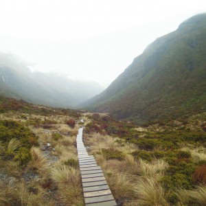
During the first day of this field trip by University of Otago senior geology students to examine the plate boundary and the Alpine Fault, we have made a series of stops, starting midway along the shore of Lake Hawea and continuing through to the fault line itself. As the road heads west, it passes down through the continental crust of the Pacific Plate—not because the road descends, but because the edge of the plate has been bent upwards by the collision with the Australian Plate.
Rocks which were once buried 25 or more kilometres beneath the surface are now exposed in stream beds and road cuttings. At Hawea the rocks have never been deeply buried and are something between sandstone and greywacke, but heading west, successively deeper burial of the greywacke with attendant increases in pressure and temperature have produced increasingly metamorphosed schists and gneisses with changing suites of minerals.
Such a complete (and accessible) series is a rare geological exposé. One American academic and writer of geology textbooks who made this same trip a few years ago confessed that he had frequently written about increasing grades of metamorphism, but had never actually seen it, and only half believed it. The rocks here completely won him over.
Although from aircraft and satellites the trace of the Alpine Fault can be more or less readily discerned, on the ground it is a different story. Centuries of erosion and vegetative growth have obscured the details very thoroughly, and the fault is nowhere obvious. Near Franz Josef we visit Hare Mare and Gaunt Creeks, places where slips along the edge of streams have shorn away soil and vegetation to expose slices through the actual fault. At both sites the rocks of the Pacific Plate have thrust out over those of the Australian Plate, and distinctive rock types mark the edge of the uplifted Pacific Plate.
Professor Richard Norris indicates the boundary between the Pacific and Australian Plates on the Alpine Fault in a slip at Gaunt Creek, north of Franz Josef. Here fine-grained cataclasite on the Pacific Plate lies over the coarse gravels of the Australian Plate.
Within 20 or 30 metres of the fault, the schist is all finely fractured into a rock type named mylonite. Within two or three metres of the fault line, the mylonite is replaced by a soft pale green clay. Cataclasite, as it is appropriately named, is just the shattered remains of schist, no longer bearing the slightest resemblance to its parent. Heat and pressure associated with movement at depth on the fault have pulverised the very fabric of the rock and destroyed or altered most of the minerals to produce a rock that is more like clay, rich in the resistant green mineral chlorite. Rivulets draining a large slip below Hare Mare Creek run milky green as the cataclasite disintegrates. On the Australian Plate side of the fault, the rocks have not been uplifted and are very ordinary gravels.
In truth, seeing the rocks of the fault exposed and the plate boundary itself is something of an anticlimax. The ordinary appearance of the features belies their true significance. Exposed in a roadside cutting, they wouldn’t warrant a second glance. As with many things in life, appearances can often be deceptive, and appreciation is the preserve of the informed.
The earlier surveys had not been tied together well between Westland and Canterbury along the main part of the Alpine Fault, but there were good measurements spanning its northern branches, the Wairau and Awatere Faults through Marlborough. Here Wellman found consistent shifts in the survey lines over the 50 years between the surveys. Even though there had been no movement on the faults themselves in that time, the wider fault zone was being strained and bent.
All the evidence told the same story: the misalignments in the Maruia shingle flats, the shifts between successive surveys and the 500 km displacement between the matching Nelson and Otago geological formations all showed a mainly horizontal shift—in which the east side of the fault was moving south relative to the west side by the equivalent of a few centimetres per year. It was clear to Wellman that the Alpine Fault had indeed been grinding along in the same direction for millions of years and hundreds of kilometres.
*
Many New zealand scientists refused to accept Wellman’s idea. He had no mechanism for his hypothesised movements, so they looked for alternative explanations to the Nelson/Otago match. But some overseas scientists greeted Wellman’s views with interest. The famous seismologist Charles Richter, who had heard Wellman’s idea at the Pacific Science Congress in 1949, called it a “bold suggestion.” A pair of American geologists were so inspired by it that they suggested there might also have been hundreds of kilometres of movement on their San Andreas Fault.
Nestled beside the Taramakau River, Highway 73 from Arthurs pass turns south, along the face of the Alps and directly along the Alpine Fault. To the north, the fault crosses the Taramakau and passes between Lake Poerua and the Alexander Range, then heads via distant saddles towards Haupiri and Springs Junction.
But it was difficult to reconcile the evidence of such large-scale horizontal movements with existing theory. As more evidence of anomalies came to light, alternative theories began to be considered. If there could be horizontal movement of 500 km as Wellman was suggesting for the Alpine Fault, then perhaps Wegener’s idea of continental drift was not so outrageous after all.
It all came together in the late 1960s. A number of ideas from oceanography, geophysics, and seismology were combined into a new theory which made sense of many aspects which had not fitted the old theory, including Wellman’s evidence of large-scale horizontal movement on the Alpine Fault. The new theory, known as “plate tectonics,” extended the notion of continental drift and provided what Wegener’s theory had lacked: an explanatory model of how drift occurred.
Plate tectonics is based on the idea that the Earth’s crust is made up of a jigsaw pattern of separate plates which are in continual slow motion, driven by great convection currents in the depths of the Earth. The plate movements operate rather like a conveyor belt. Under the oceans, where the crust is thin, new crust is continually being created by upwelling of molten rock at mid-ocean rifts, which then spreads out in both directions as a rigid plate. At the outer edge of the plate, where it runs up against the adjoining plate, one of them is pushed down or subducted under the other to sink back down into the hotter regions, where it melts again and completes the cycle.
Most of this movement goes on under the sea, hidden from sight. Land areas, which are formed of thicker, lighter “continental” crust, are mainly passive, hitchhiking passengers in the process, and give geologists few signs of what is happening.
Harold Wellman (left) and geologist George Grindley enjoy an appropriately geological diversion: a soak in a hot spring issuing from the Alpine Fault at Haupiri, about 1950. While many geologists were initially sceptical about Wellman’s claims of hundreds of kilometres of horizontal movement along the fault, his work became a stepping stone to the new theory of plate tectonics that informs the way we now view the Earth.
Even when continental crust reaches the edge of a plate, and the adjoining plate of thinner, denser “oceanic” crust is pushed down under it, the signs of the collision are not obvious. But in a few places, where two colliding plates both have continental crust at their edges too thick and too light to be pushed under, the results are spectacular. The great pile-up of the Himalayas is one such place. Another, where the plates are colliding at a more oblique angle, is the Alpine Fault.
Especially now that we have the longer view provided by satellite photographs from out in space, we can see the Alpine Fault as one of the clearest marks on the planet of the plates moving within its skin. The South Island lies across the edges of the Australian and Pacific Plates. To the north, the oceanic crust of the Pacific Plate is being pushed down under the continental crust of the North Island from the east, and to the south the oceanic crust of the Australian Plate is being pushed down under the continental crust of Fiordland from the west. In between, continental crust meets continental crust. Westland and Nelson along the edge of the Australian Plate, and the rest of the South Island along the edge of the Pacific Plate, grind against each other, pressing together so hard that the edge of the Pacific Plate is buckled up into the long wall of the Southern Alps and its foothills extending back east across the South Island. The inexorable motion of the plates has made New Zealand a land uplifted high, splintered by faults, and jarred by earthquakes.
*
Harold Wellman now I in his late 80s, lives quietly in retirement high on fault- uplifted hills overlooking Wellington. He still has the gift of being able to think in three dimensions when most of us struggle with two, and still likes to demonstrate the essential simplicity of his ideas in graphic models. Then I climbed the steps to see him, he patiently explained once more the movement on the Alpine Fault, which had seemed so clear to him but which took others years more to see.
To make it plain to me he took the scissors and cut a geological map of the South Island along the line of the Alpine Fault and showed me how sliding the two sides back along the line of the Alpine Fault brought the geological formations in Nelson and Otago into alignment.
The conclusion that there must have been 500 km of horizontal movement seems obvious now, but it took Wellman’s perspicacity and a revolution in science to make it so.
Past and future shocks
Earthquakes in New Zealand occur along a swathe of terrain from the Bay of Plenty to Fiordland, a band broadly parallel to the boundary between the Pacific and Australian Plates. Indeed, it is the jostling between these plates as one is forced under the other that gives rise to most earthquakes.
Yet between Springs Junction and northern Fiordland—along the main section of the Alpine Fault—there is apparently an area of relative repose. Does this mean that the fault has become inactive, that we can forget about it as we fill up at the Franz Josef petrol station, where the fault line runs through the forecourt?
Regrettably, scientists consider that the quiet along the western front of the Alps is merely one of the longer intermissions that fall between the brief bouts of activity that mark this fault.
In general, small, frequent earthquakes on faults are preferable. They mean that the land is regularly making accommodations in response to the strains imposed upon it. Along the Alpine Fault these modest accommodations are not happening. Both sides of the fault are thought to be locked firmly together, perhaps for hundreds of kilometres, and stress levels will build up until the fault is forced to rupture, probably in a dramatic earthquake.
In September 1998 a scientific workshop was held at the Institute of Geological and Nuclear Sciences (IGNS) in Lower Hutt to give geologists studying the Alpine Fault an opportunity to present and discuss their findings as they have attempted to sift clues from vestiges of past earthquakes to gain a glimpse of what the future may hold.
Among those taking part were Richard Norris and Alan Cooper from Otago University and Kelvin Berryman of IGNS, who have been studying the Alpine Fault for 20 years. They have been using excavators to dig trenches across the fault on the terraces at Haast and also at Okuru, 15 km south of Haast, in an attempt to learn more about recent movements on the fault. From soil and rock disturbances exposed in the trenches, they are convinced that there have been three major earthquakes (“events” in geological parlance) on the fault in the past 900 years, but pinning dates on these events is difficult. The sediments that make up the terraces are derived from old rocks, so dating these is pointless, and though plant matter from the relevant sediment layers can be dated using carbon 14, who can be sure that it was not washed into the layer by a later flood, moved by root disturbance, or even shifted by a later event?
Despite the uncertainties, the trio consider that the earliest of the three events took place 900 years ago, the second 650 years ago and the third somewhat more recently. Two of the events produced a total of 16 m of horizontal displacement (offset) and the three events a total of 25 m—suggesting a relatively constant eight-metre horizontal offset for each event (equating to about 25 mm of horizontal movement per year). By global standards these are major fault ruptures, and correspond to huge earthquakes.
North of Inchbonnie (west of Arthurs Pass) the Alpine Fault splits into several limbs, including the Hope, Clarence and Awatere Faults running out to the coast through Marlborough, with the main fault continuing in its later stages as the Wairau Fault. Mark Yetton of Canterbury University has done trenching at several sites along the Alpine Fault between Springs Junction and Inchbonnie, finding evidence of several events in the past millennium. In this northern part of the fault, movement seems to be slower, perhaps 2.5 mm per year vertically and 6 mm per year horizontally. Some plate movement may be taken up on the other Marlborough faults mentioned, and this could account for the slower movement on the main fault.
Studying closely-packed annual growth rings–as many as 900 in a 25 cm-wide slice–in rimu that once grew near the Alpine Fault has enabled MSc student Craig Wright to determine that tree growth was particularly poor in 1717, 1580, 1445, and 1210. Major earthquakes in those years provide a plausible explanation for the trees’ arrested growth.
John Beavan of IGNS has been using a very accurate version of the global positioning system to measure the movement of 115 markers at various sites over the central section of the South Island. The relative positions can be determined from satellites to within a few millimetres. Although his measurements have been collected only over four years, they indicate that the central South Island east of the Southern Alps is headed west-south-west at about 30 mm per year relative to the West Coast on the Australian Plate. The strain of these differences in movement is taken up by a 20-km-wide band of rocks east of the Alpine Fault.
Surprisingly, botanical studies are providing at least as much information about past earthquakes on the Alpine Fault as are the rocks.
Many native trees on the West Coast are long-lived—some surviving for 1000 years or more. Major earthquakes damage tree roots, smash off branches and shake down innumerable rockfalls, which sweep away forest and dam rivers. Trees may be damaged or drowned in the lakes that form, and many more will be swept away downstream when the lakes burst. Debris from the rockfalls in the upper reaches of river valleys will choke more forest when it eventually washes down to the flats.
Even if trees are not killed, their growth may be adversely affected. Craig Wright, an MSc geology student at Otago University, has looked at tree rings from 20 trees, most of them old rimu once growing near the fault. Slices of trunk have been cut from stumps of milled trees, then smoothed and polished. Each year the tree lays down an annual growth ring, so provided a felling date is known, the dates of any growth disturbances can be determined by counting back through the rings.
Wright’s work indicates that growth was particularly slow in 1717, 1580, 1445, 1210, 900 and 500. It is impossible to attribute these growth difficulties conclusively to major events on the Alpine Fault, but their low frequency would seem to rule out storms, floods and maybe even droughts.
Wright also looked through sediments in the bottoms of sag ponds—small ponds which form along fault lines where drainage patterns have been upset by earth movements. During earthquakes, larger amounts of plant matter able to be dated by carbon 14 might be expected to accumulate among the sediments in such ponds, and he found evidence for three events in the past 1500 years.
William Bull, an American researcher who conducts field work in New Zealand mountains, has suggested that measuring the size of lichen growths on rockslichenometry—can also be used to date Alpine Fault earthquakes. Rocks, dislodged from mountains by earthquakes, expose bare surfaces suitable for lichen growth. Measuring the size of lichens gives good information as to their age. When thousands are measured (Bull has 34,000 measurements from many South Island mountains, but not from the West Coast, where it is too wet for lichens) and the frequencies of the various sizes are plotted, a rather irregular size distribution is obtained. It appears that in particular years and at particular locations many more lichens started growing than in most years. Bull considers that these are the years in which large earthquakes triggered widespread rockfalls. One difficulty with his data is that there are more years of vigorous growth than are consistent with the number of large earthquakes thought to have taken place in the past.
A PhD student in botany from Lincoln University, Andrew Wells, has been doing something a little similar with West Coast forests. By counting the rings in tree cores taken with a special borer, he has discovered that many of the trees in a stand are the same age. Wells has assembled data from 55 sites throughout Westland (not all of it his own) and found that most trees on the Coast started growing at only a few specific times. Some 6 per cent of stands date from about 1430, approximately 40 per cent from 1610 to 1630, 35 to 40 per cent started growing between 1710 and 1730, and about 10 per cent from 1810 to 1850 (this last age group is seen only in some locations, especially in the south).
Wells cannot be accurate to the year because the early growth of trees before they lay down rings is very slow. In the Karangarua catchment (where Wells has done much of his work) some trees take 28 years to reach a height of one metre. Wells’ results suggest that major disturbances to the land and forests on the West Coast preceded each of these periods of forest re-establishment.
The geological and botanical data dovetail nicely in that earthquakes provide a reasonable explanation for puzzling botanical findings, and tree ages provide much more accurate dating for relatively recent geological events than carbon-14 dating.
Although not all the data are concordant, several quite robust results do emerge. There have been a number of major earthquakes on the Alpine Fault in the past thousand years. The last was probably in 1717, and could have involved 400 km of the fault moving by up to 8 metres horizontally, with a smaller vertical movement.
Other events of similar magnitude probably took place about 1620, 1445 and 1100. Some of these events may have affected only sections of the fault, and none of them necessarily involved the section north of Springs Junction, which has been little studied. Assuming these dates are correct, 350 years passed from 1100 to 1445, 175 years from 1445 to 1620, 100 years from 1620 to 1717, and 280 years from 1717 until the present. Geological results indicate that over the past 1000 years the southern part of the fault has moved at a rate equivalent to 25 to 30 mm per year, and contemporary GPS results indicate that the same degree of relative movement between the Pacific and Australian Plates is still occurring.
Geologists clean down the walls of a trench excavated across the Alpine Fault where it traverses river terraces near Haast. Careful analysis of the sediments and soils exposed in the wall of the trench indicated that three large earthquakes had disturbed the area in the past 900 years.
Based on past trends, one would have to say that the Alpine Fault is due—and maybe overdue—for another major earthquake. Indeed, the land traversed by the fault is considered more likely than anywhere else in the country to experience a large earthquake in the foreseeable future. The magnitude of the quake would most likely be between 7.5 and 8 on the Richter scale.
It is worth recalling that the Richter scale is logarithmic; a magnitude 8 quake releases 30 times the energy of a magnitude 7. Such a quake could have serious consequences over a broad area of the South Island, for if it was similar to the last event, it could rupture a 400 km section of the Alpine Fault, from Milford Sound to north of Arthurs Pass.
Soil liquefaction has been recorded 200 km distant from a magnitude 8 earthquake, and Christchurch is within that range. (Liquefaction can be a problem on poorly consolidated ground. Foundations may be undermined and buildings may topple or sink.) Places such as Wanaka and Ashburton are somewhat closer, and have not experienced a quake of this size before.
Queenstown, Timaru, much of central Otago and most of the West Coast including Franz Josef, Hokitika and Greymouth would be affected.
The humble lichen can provide clues to the timing of earthquakes. Following large quakes, many boulders are shaken down ready for colonisation by lichens. Because the size of lichen gives an accurate indication of its age, finding an usually large number of similar-sized individuals suggests the time an earthquake could have occurred.
Buildings would be damaged, fires started and lives lost at the time of the quake, but problems would continue for some time, especially on the West Coast. Aftershocks could be almost as severe as the original event, and lesser shakes might continue for weeks. Rivers could be dammed by avalanches shaken down by the quake, only to breach sometime later and release a potentially devastating flood.
It is very likely that State Highway 6 down the West Coast would suffer major damage at many sites (it crosses the faultline perhaps half a dozen times) and weeks might elapse before road connections could be reestablished.
Many of the district’s bridges would be destroyed, and replacing them would present a major difficulty. Streams and rivers would be carrying a vastly increased load of sediment as they cut through rock slides in the mountains. This extra load would cause river beds to rise rapidly, perhaps for as long as 50 years following the quake. Rebuilding bridges under such circumstances would be a major headache.
At Franz Josef this problem is already real. The retreating glacier has caused considerable aggradation in the Waiho River, so that its bed is now several metres higher than the adjacent camping ground, and the deck of the bridge is only a metre or two above the river bed. Plans to build a new bridge with the deck 15 m higher have been considered. Rebuilding dozens of bridges in this way would be a massive project, yet without such an undertaking road communication on much of the Coast could be impossible for decades following the next big one.