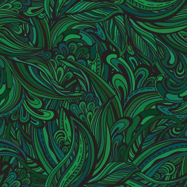


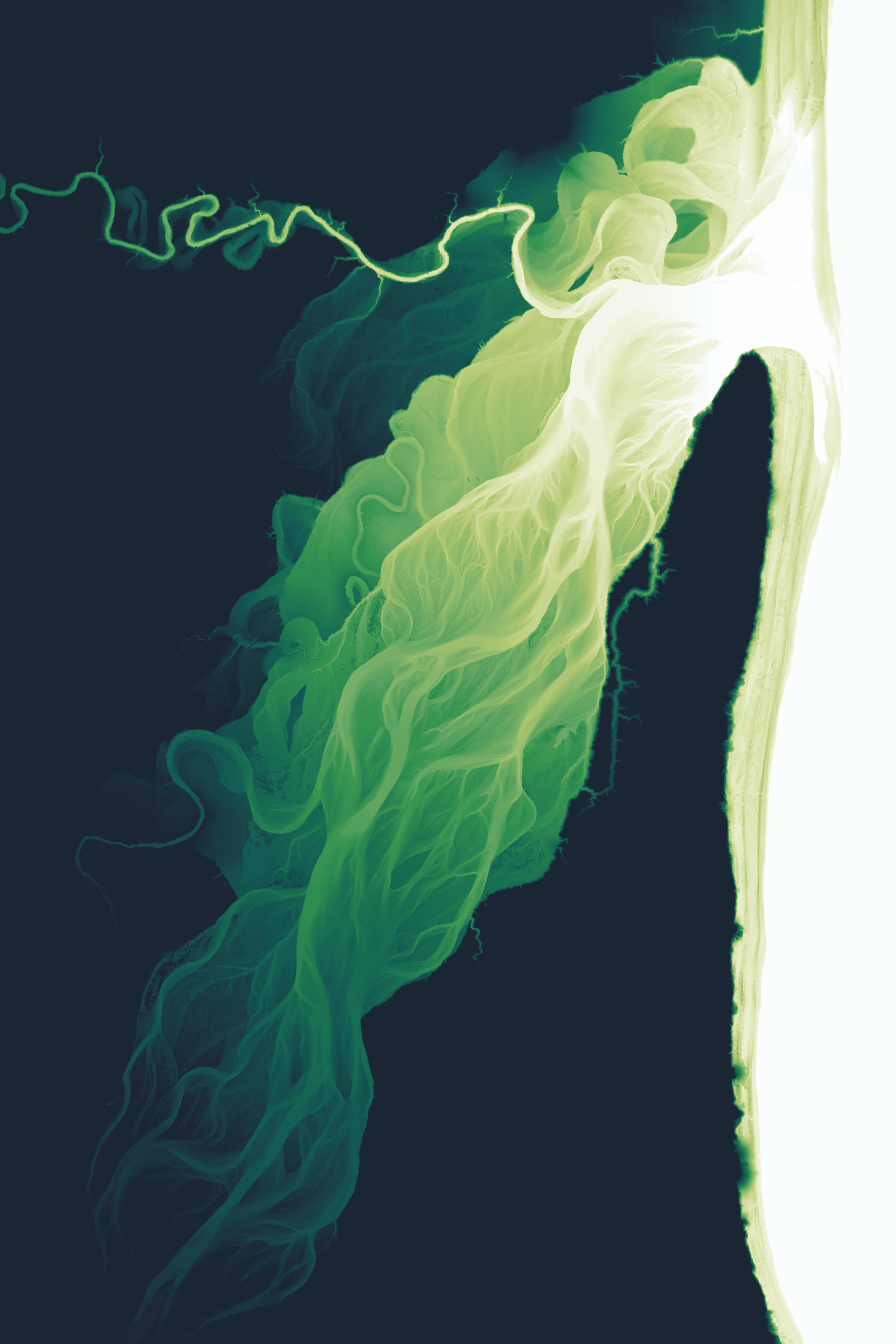
Waiapu River, a treasure of Ngāti Porou, is now known, too, for its volatility. After decades of forestry thrashing the land, every major storm pushes silt and pine slash downriver to the people and beaches of Tairāwhiti.
This image, showing where the river meets the coast at Gisborne, is based on aerial LiDAR data collected between 2018 and 2020—three years before Cyclone Gabrielle. It was created by US cartographer Daniel Coe, who became fascinated by rivers via kayaking, and has now mapped hundreds of them worldwide. His work strips away vegetation, buildings and even water, tracing instead the ghost channels of each river’s past.
The green is purely an aesthetic choice, he says. The gradient of colour is what matters: it depicts elevation, so the deepest river channels are bright white. And the small puffs of green along the coastline? Those are likely to be minor drainage points, Coe says, where yet more sediment is heading out to sea.