

The Canterbury earthquakes changed the shape of Christchurch. Much of the city is built on sand and silt, with shallow water tables and active faults. This combination meant the ground was ripe for liquefaction. Saturated soils responded to prolonged shaking by behaving like quicksand.
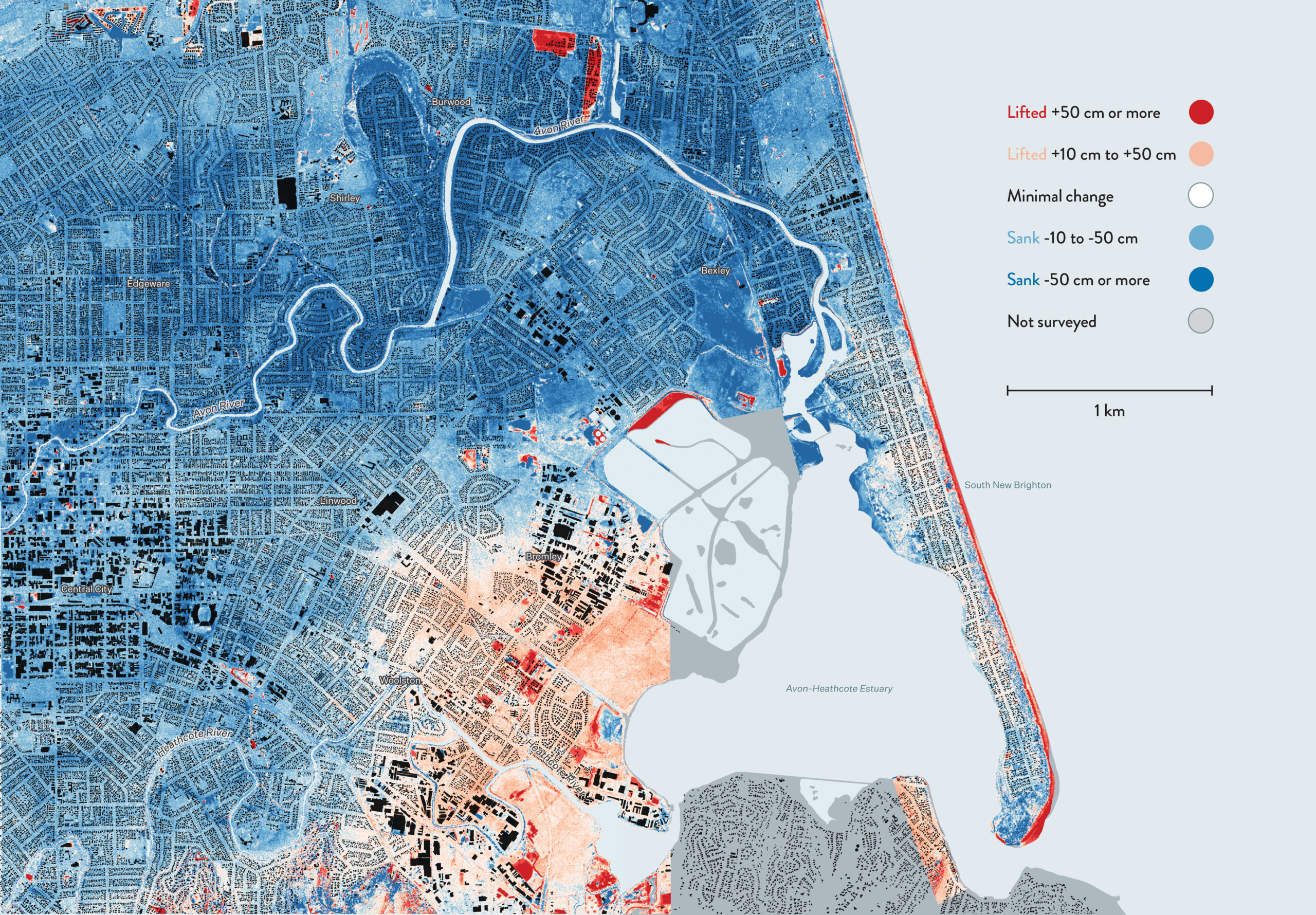
Waterlogged silt bubbled up from the ground to cover streets and gardens. Around 86 per cent of central and eastern Christchurch subsided. Most of this subsistence was caused by liquefaction. Some properties, especially along the Avon River, sank half a metre or more. Meanwhile, buried faults caused uplift in the Port Hills, the Avon-Heathcote Estuary and Woolston.
This map shows how the land’s surface changed between a pair of surveys in 2003 and 2012. Most of the differences in elevation are due to the Canterbury earthquakes. Some uplift pockets, though, are the result of human activities, such as new housing developments and filling in salination ponds.
The blue parts of the map sank between 2003 and 2012. The red areas lifted up.
More by Chris McDowall
